
Table of Contents >> Show >> Hide
- The “Mountaintop” Part Isn’t Clickbait
- How LiDAR Turned “Hills and Grass” Into a City Map
- Meet the Twin Cities: Tashbulak and Tugunbulak
- Why This Rewrites the Silk Road Map
- How Do You Feed a City Where Farming Is Tough?
- The Steel (Yes, Steel) Factor
- Ideas Traveled Uphill Too
- So… Was the Silk Road a Road or a Web?
- What Comes Next: The Questions This Discovery Forces Us to Ask
- Experiences on the Mountain Silk Road: What It Feels Like Today
- Conclusion: The Silk Road Was Biggerand HigherThan We Imagined
If you grew up picturing the Silk Road as a polite line of camels plodding through deserts from “China” to “Europe,”
I’ve got news: the Silk Road was never that tidy. It was a messy, shifting, choose-your-own-adventure web of routes
and now it looks like some of the biggest chapters happened in places historians once treated like the “Do Not Enter”
sign on a hiking trail.
High in the rugged mountains of southeastern Uzbekistanat elevations where your lungs start negotiating termsresearchers
used drone-based LiDAR (laser scanning) to map two medieval cities: the already-known Tashbulak and a much larger neighbor,
Tugunbulak. The scans revealed sprawling fortifications, plazas, roads, terraces, and dense clusters of buildingsevidence of
serious urban life in a landscape many experts long assumed couldn’t support it.
In other words: the Silk Road didn’t just pass through the mountains. It apparently moved in, built walls, smelted iron, hosted gatherings,
and shaped history. “The road ran uphill” is no longer a cute metaphorit’s a working hypothesis with city-sized receipts.
The “Mountaintop” Part Isn’t Clickbait
Tugunbulak and Tashbulak sit around 2,000–2,200 meters (roughly 6,500–7,200 feet) above sea level. Today, fewer people live at that
elevation globally than live in a single major metro area. In the medieval period, building and sustaining cities up there meant solving
problems that don’t show up in lowland oasis settlements:
- Short growing seasons and unreliable farming
- Cold winters and big temperature swings
- Steep terrain that complicates roads, construction, and daily life
- Logisticsfeeding people and animals when you can’t just “pop down to the market” without a multi-hour descent
That’s why the discovery hits so hard. It’s not just that two sites exist. It’s the scale and planning revealed by the scans.
Tugunbulak, in particular, looks like a full-bodied city, not a lonely fortress with good views and bad Wi-Fi.
How LiDAR Turned “Hills and Grass” Into a City Map
To the naked eye, these places can look like rolling, grassy fields with the occasional moundeasy to mistake for natural bumps or
“some old stuff over there.” LiDAR changes the game by firing laser pulses and measuring how they bounce back, generating a dense 3D
“point cloud” of the ground surface. In rugged mountain landscapeswhere erosion, deposition, and vegetation can hide structuresthis
kind of mapping can reveal subtle traces of walls, roads, terracing, and building footprints.
Here’s what makes this particular effort feel like a “Silk Road plot twist” instead of a routine survey:
the drone-based LiDAR produced extremely high-resolution models across a large area. Then researchers paired the models with
computational methods to help identify and trace features consistently. The result: a plan that shows monumental architecture and
fortifications spread across what amounts to hundreds of acres.
Think of it like this: before, archaeologists could say, “Something happened here.” After LiDAR, they can say,
“Here’s the road. Here’s the wall. Here’s the terrace. Here’s the clustered neighborhood. Here’s the defensive line overlooking the valley.”
It’s the difference between finding a single LEGO brick and discovering the instruction booklet.
Meet the Twin Cities: Tashbulak and Tugunbulak
Tashbulak: A High-Altitude Town With a Big Story
Tashbulak is the smaller of the two, but “small” is relativeespecially when “small” still means an organized settlement with defensive
structures, terraced platforms, and a community that persisted for centuries. Archaeological work has also highlighted cultural and religious
significance, including evidence tied to early Islamic presence in the region.
This matters because the Silk Road wasn’t just a conveyor belt for silk. It was also a system for moving people, beliefs, technologies,
and political influence. A place like Tashbulak can function as both a local hub and a node in larger ideological networksexactly the kind
of “middle of the map” story that gets ignored when we only stare at famous endpoints.
Tugunbulak: The Surprise Metropolis Hiding in Plain Sight
Tugunbulak is where the “changing everything” headline earns its keep. The LiDAR mapping suggests a vast, fortified urban complex with
multiple zonesdefensive lines, central fortified areas, and broad spreads of architecture. Researchers have described it as a large-scale
highland urban center positioned at a mountainous crossroads of medieval Silk Road routes.
And it’s not just big for the mountains. It’s big, periodespecially for a region where our mental image of major medieval Central Asian
cities tends to stick to lower-elevation oases. Tugunbulak forces a new question: how many other “mountain blank spots” on our historical maps
are actually filled with forgotten infrastructure?
Why This Rewrites the Silk Road Map
For decades, popular storytelling has treated the Silk Road like a line connecting a few marquee cities. Historians and archaeologists have long
known it was a network, but even networks have biases. One stubborn bias has been that the “real” Silk Road action happens in the lowlands:
flatter ground, bigger farms, easier caravans, and obvious city ruins.
The mountaintop cities flip that assumption. They suggest that highland routes weren’t just emergency detours or seasonal shortcutsthey could
be economically and politically central, especially when powered by what mountains can provide in abundance:
- Ore and fuel (iron sources, plus access to wood or charcoal production in some zones)
- Pasture for large herds (a form of mobile wealth that can also feed people)
- Control of passes (the ability to monitor, tax, protect, or pressure movement)
- Strategic defensibility (harder to attack, easier to watch)
In plain English: if you want to trade across Eurasia, you don’t just need an oasis. You need options.
Mountains are full of optionsif you can manage them.
How Do You Feed a City Where Farming Is Tough?
The most reasonable objection is also the simplest: “Okay, but what did they eat?” Mountains can be stingy with grain.
The emerging picture is that these communities likely combined high-altitude herding with trade and supply from lower elevations.
Archaeological evidence from the region has included signs of imported or transported foodsgrains and legumes, fruit remains, and other plant materials
alongside animal-based resources typical of pastoral economies. That kind of mixed economy is exactly what you’d expect from a Silk Road node:
not self-sufficient in a modern homesteader sense, but deeply connected in a network sense.
This also reframes the old “nomads versus city people” story. The mountain cities suggest that pastoralist groups weren’t merely passing through
urban systems created elsewhere. They could build their own forms of urbanismdistinct in layout, economy, and political organizationwhile still
plugging into long-distance exchange.
The Steel (Yes, Steel) Factor
One of the most exciting threads is metallurgy. Evidence associated with furnaces, slag, and industrial-scale iron working has fueled the idea
that Tugunbulak may have been more than a trading stopit may have been a production engine.
That matters because metal is the kind of commodity that makes a tough location suddenly make sense. If a place sits near ore sources and can
produce high-value goodstools, weapons, hardware for carts and buildingsit can trade those goods for grain, textiles, ceramics, and everything
else a city needs. A mountain settlement doesn’t need to grow wheat if it can mint value in another form.
Medieval texts also describe an iron-working city in this broader areasometimes referred to as Marsmandaassociated with fairs and iron objects.
Researchers have suggested Tugunbulak could be a candidate for that kind of historically attested “iron city,” though the identification remains
a hypothesis that future excavations will have to confirm or reject.
Ideas Traveled Uphill Too
The Silk Road’s most famous exports weren’t always things you can pack in a saddlebag. Religions, languages, artistic motifs, and political
alliances moved along the same routes as silk and spices. The mountain cities offer a vivid reminder that belief systems didn’t only spread through
imperial capitalsthey also flowed through regional hubs and frontier communities.
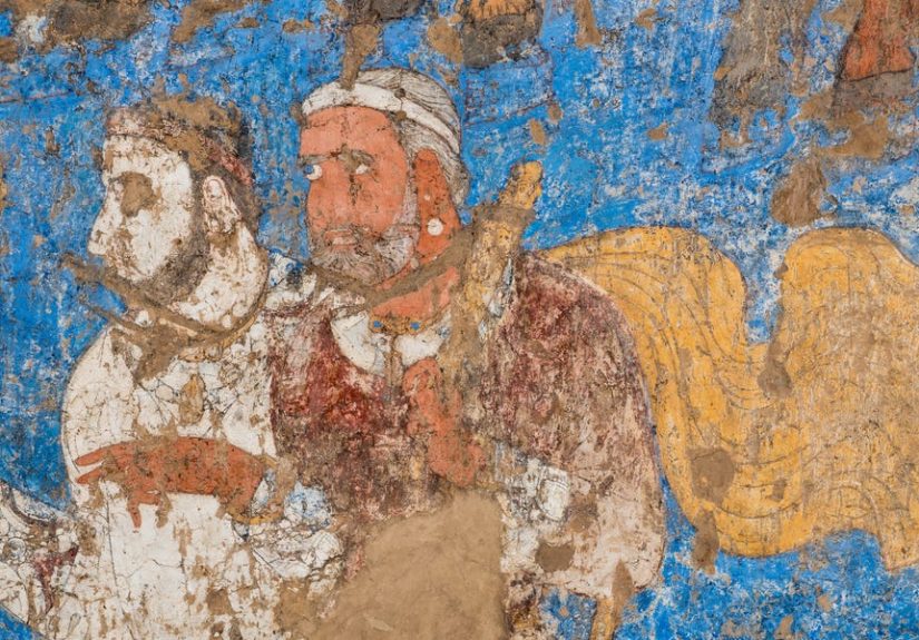
Tashbulak’s evidence of early Islamic influence (including a significant burial landscape) suggests the mountains were not isolated backwaters.
They were connected, participating in the same broad cultural transformations that reshaped Central Asia in the medieval period.
That’s the part that really changes the story: the highlands weren’t just physically connected to the Silk Road networkthey were intellectually
and spiritually connected too.
So… Was the Silk Road a Road or a Web?
If you’ve ever argued with a map app that insists your destination is “14 minutes away” while ignoring the river, the closed bridge, and your lack
of a kayakcongratulations, you understand why the phrase “Silk Road” is misleading. It was never a single road. It was a shifting web of routes
used over many centuries, with trade corridors that changed as empires rose, climates fluctuated, markets shifted, and security conditions improved or collapsed.
The mountaintop discovery doesn’t erase the importance of lowland oasis cities like Samarkand. Instead, it adds an overlooked layer:
mountain corridors that could host large communities and play a central role in exchange. The Silk Road story becomes less like a straight line and
more like a braided river systemmultiple channels, splitting and rejoining, with different branches carrying different cargo at different times.
What Comes Next: The Questions This Discovery Forces Us to Ask
LiDAR can reveal shapes and outlines, but archaeology still needs boots-on-the-ground confirmation. The big next steps involve testing the hypotheses
the maps create:
- Dating: refining timelines of construction, occupation, and abandonment with excavations and lab analysis
- Economy: determining the true scale of iron production and identifying trade goods moving in and out
- Food systems: tracing what was local versus imported through plant remains and animal-bone analysis
- Population: estimating how many people lived there year-round versus seasonally, and what kinds of gatherings occurred
- Regional mapping: using similar remote sensing to locate additional highland nodes that may connect into a broader system
The most exciting possibility is that Tugunbulak and Tashbulak are not rare anomalies. They may be the first clearly mapped examples in a broader
category of high-altitude Silk Road urban centersplaces we missed because we assumed mountains were margins.
Experiences on the Mountain Silk Road: What It Feels Like Today
You don’t need a drone or a doctorate to understand why this discovery is so emotionally powerful. All you need is to imagine standing on a ridge
in the Uzbek highlands where the air feels sharperlike it’s been filtered through stone. The modern landscape can look almost empty at first glance:
sloping grasslands, scattered juniper, a stream threading through a narrow valley. Then you notice a mound that’s too geometric to be purely natural,
a line that runs too straight to be a random rockfall, a terrace that looks suspiciously like someone once tried very hard to make a mountain behave.
The wild part is how quickly your brain starts swapping timelines. One second you’re thinking about weather and footing; the next you’re picturing
a city waking up in the thin morning lightsmoke rising from kilns, animals shifting in corrals, people moving along paths that are still faintly
visible in the slope. In places like this, “ruins” don’t always look like movie sets. They can feel more like a secret that the landscape is
only half interested in keeping.
There’s also a humbling lesson in how mountains mess with modern assumptions. From a comfortable chair, it’s easy to think: “Nobody would build
something huge up there.” But walk the terrain (even in your imagination) and you start seeing the logic. Valleys funnel movement. Passes create
chokepoints. A fortress on a ridge doesn’t just look dramaticit looks useful. And if your community already knows how to live with herds,
move seasonally, and trade for what you can’t grow, the mountain stops being a barrier and starts being a strategic asset.
Another experience this story unlocks is a different way of thinking about travel itself. The Silk Road is often romanticized as a long,
glamorous corridor of luxury goods. The mountains remind you it was also a grindcold nights, steep climbs, sudden storms, and the constant math
of risk versus reward. Yet people still came, again and again, because the payoff wasn’t only silk or spices. It was access: to markets, to protection,
to alliances, to information, to faith, to opportunity. In a highland city, you can almost feel that social electricitypeople arriving in pulses,
trading and talking, then dispersing back out along multiple routes like sparks from a fire.
And yes, there’s a slightly funny modern echo, too. We like to joke that “the Wi-Fi is bad in the mountains.” Medieval traders didn’t have Wi-Fi,
but they did have something just as valuable: a network. These highland hubs weren’t isolated; they were connectedby paths, by commerce, by shared
needs, and by the very human instinct to gather where exchange is possible. Standing in a place like Tugunbulak (or even just reading about it),
you realize the Silk Road wasn’t a straight line you follow. It was a living system you plug into.
Conclusion: The Silk Road Was Biggerand HigherThan We Imagined
The mountaintop discovery in Uzbekistan doesn’t just add two dots to a map. It challenges a deeply rooted habit: treating mountains as blank space
between “important” places. Tugunbulak and Tashbulak suggest that highland communities helped power the medieval Silk Road with industry, herding,
strategic control of routes, and cultural exchange. The Silk Road didn’t merely cross the mountains. In at least one region, it built cities there
and those cities may have shaped the politics and economy of Eurasia more than we’ve given them credit for.
If history is a map, LiDAR just handed us a better legend. And it turns out the mountains were never “the edge.” They were part of the center.